• Română
  • English

Cercetări Arheologice

Journal of the National Museum of Romanian History

  • About
    • Aims and scope
    • Open Access policy
    • Authors guide
    • Evaluation process
    • Editorial team
    • Ethics and malpractice statement
    • Authors index
  • Journal archive
  • Public Archaeology
  • Contact
  • Submit
  • About
    • Aims and scope
    • Open Access policy
    • Authors guide
    • Evaluation process
    • Editorial team
    • Ethics and malpractice statement
    • Authors index
  • Journal archive
  • Public Archaeology
  • Contact

The Roman frontier in Dobrudja: 9. Traian

  • Home Public Archaeology
  • The Roman frontier in Dobrudja: 9. Traian

Traian

Traian
Location: Cerna commune, Tulcea county (RAN: 160163.01; TL-I-s-B-05941)
Traian - fotografie aeriană oblică
Traian, quadriburgium - aerial oblique photograph

The fortification is on the edge of a narrow and elongated promontory, oriented east-west towards the Danube. The hill called Cale-Bair (toponym translated as Dealul Cetății) is located on the land inside of the village. Access is from the road DJ 222b.

Some contemporary authors have included this fortification among those inside the defensive system because nowadays the course of the Danube is 7 km to the west. Extensive land reclamation works conducted half a century ago, had the effect of draining all the secondary watercourses in this area, the nearest water shine being lake Traian, located 1 km away.

Traian, quadriburgium - ortofografie
Traian, quadriburgium - orthophotograph

The quadriburgium-type fortification was reported as early as the 19th century, the first plan being drawn out by P. Polonic, depicting a square with a side of 60 m. Satellite images, as well as the processing of data collected with drones, give us the image of a rhomboid fortification, the length of the sides of which is almost 60 m. By the outline of the tower on the southern corner, we can assume that they all had the same shape. Monetary finds (a treasure hoard from the time of Emperor Justinian) indicate the functioning of the fortification at least in the second half of the 6th century AD.

Traian, quadriburgium - model digital al terenului
Traian, quadriburgium - digital terrain model
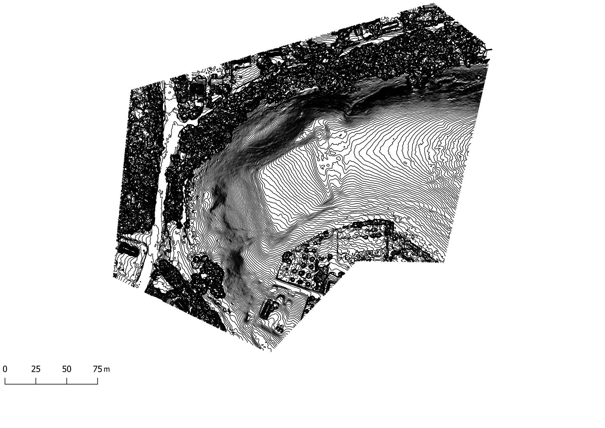
Traian, quadriburgium - planul fortificației
Trajan, quadriburgium - fortification plan with contour lines in 10° detail

Part of the study:

Ovidiu Țentea, Ioan C. Opriș, Florian Matei-Popescu, Alexandru Rațiu, Constantin Băjenaru, Vlad Călina, Frontiera romană din Dobrogea. O trecere în revistă și o actualizare, Cercetări Arheologice, Vol. 26, pag. 9-82, 2019, doi: https://doi.org/10.46535/ca.26.01

Read the paper
See the series

Bibliography

Polonic 1935, 22; TIR, L 35, 73; Băjenaru 2010, 129.

Logo

National Museum of Romanian History
Calea Victoriei 12, 3 rd District, 030026 Bucharest, Romania
Secretariat
E-mail: direct@mnir.ro Tel: +40 21 315 82 07 Fax: +40 21 311 33 56

Visit us
Correspondence

Editorial team:

cercetari-arheologice@mnir.ro


Silviu Oţa:

silviuota@yahoo.com

Cercetari Arheologice Logo

Cercetări Arheologice Journal
Calea Victoriei 12, 3 rd District, 030026 Bucharest, Romania
ISSN (print): 0255-6812
ISSN (online) : 2821-806X
ISSN-L: 0255-6812
Publisher: National Museum of Romanian History
Editorial board
E-mail: contact@cercetari-arheologice.ro
Editor in chief: Silviu Oța
E-mail: silviuota@yahoo.com

Creative Commons Licence
This work is licensed under a Creative Commons Attribution-NonCommercial 4.0 International License
Contributions
In memoriam (3) Note (22) Rapoarte de săpături (171) Recenzii (38) Studii (410) Studii pluridisciplinare (22) Varia (24)

Copyright notice  |  Privacy Statement

Copyright © 2026 Muzeul Național de Istorie a României

Powered by LUTHONIUM