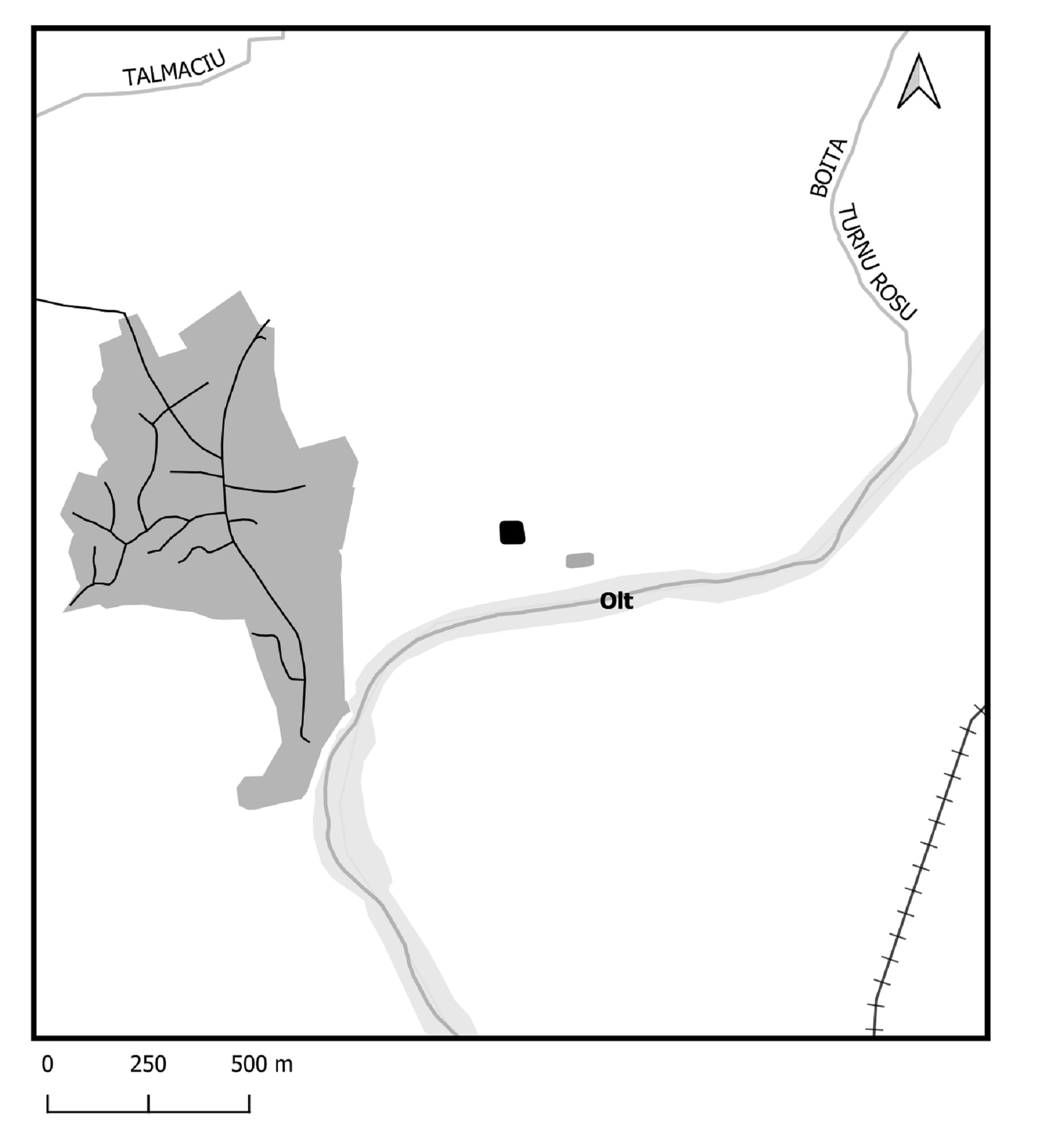
Boița (Caput Stenarum?, Tabula Peutingeriana VIII, 1)
Location: Tălmaciu commune, Sibiu county (RAN: 145845.01, SB-I-m-A-11946.01)
Oblique aerial photo, view from the west (November 2020)
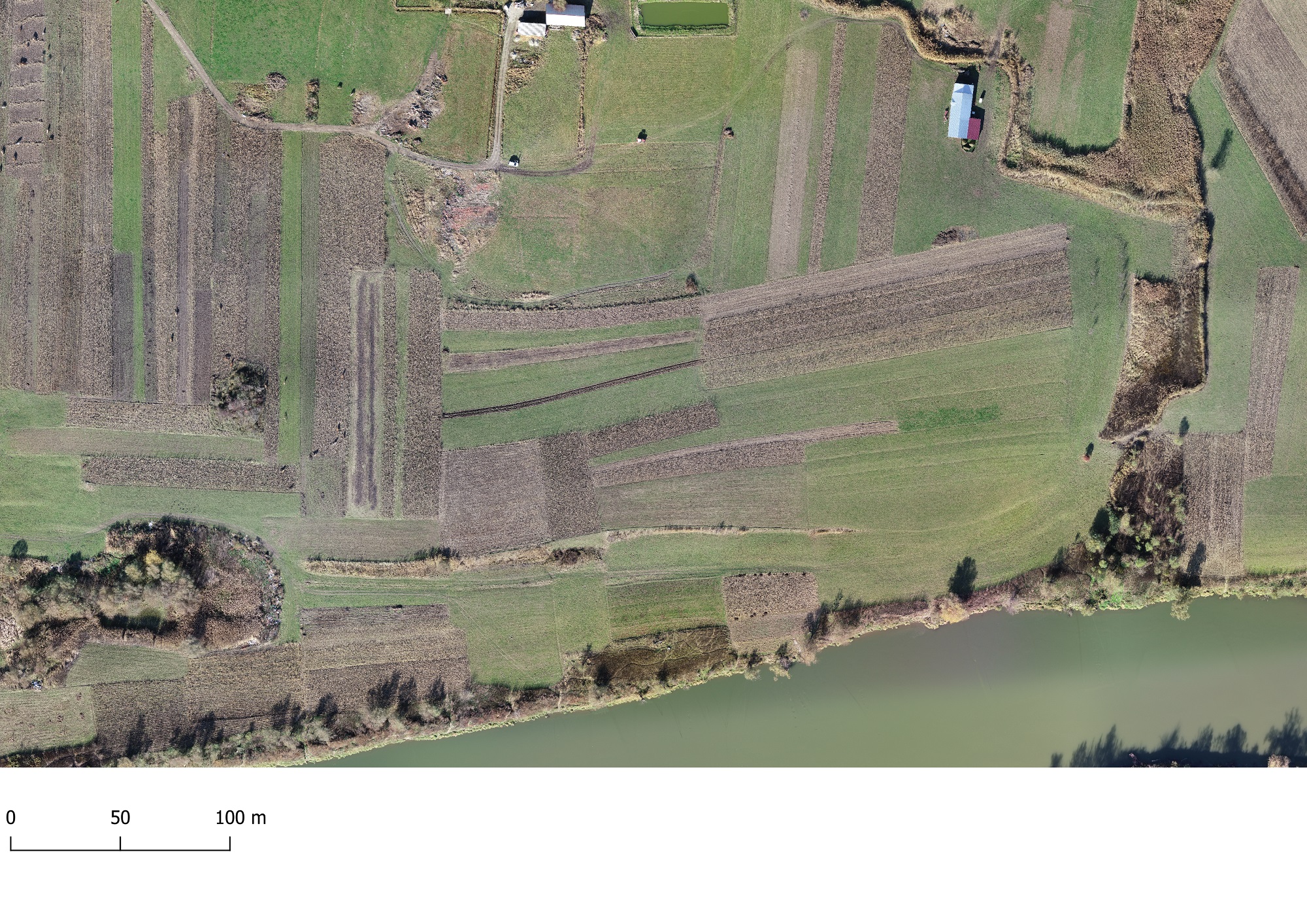
The Roman fortification at Boița is located in close proximity to the bend of the Olt river, before entering the gorge. About 2 km east of the present village, at Rude / La Rude, on the high terrace to the right of the Olt are partially visible traces of the Roman fortification, especially the earth resulting from archaeological excavations, without distinguishable ruins. In the fields, following the agricultural works, numerous traces of Roman origin can be easily identified, especially on the edge of the high terrace, southeast of the fortification.
Oblique aerial photo, view from the west (November 2020)
Following archaeological research (M. Macrea et al. 1957; N. Lupu 1958; 1968-1976; N. Branga 1979) no coherent plan was published. Ioana Bogdan-Cătăniciu proposed some additions to some defensive elements of the fortification.
We are dealing with a quadrangular fortification, with rounded corners and dimensions 45×50 m; a double wall of 1.50 m thick, surrounded by a double defence moat; on the west side a gate was partially identified. The discovery of a stamp with the name of the Legion XIII Gemina (IDR III/4, 84) led to formulate the hypothesis about the presence of a detachment of the legion in the early years of Roman rule in Dacia (Bauvexilation ?). A stamp of the type COHN… (IDR III/4.85) was also discovered, assigned to the cohort I Tyriorum sag, respectively I Commagenorum sag, there are no decisive elements in favour of any hypothesis at this time. Based on this argument, but without there being enough elements to establish a chronology, we can talk at this point about the use of ceramic building material, marked with these stamps.
Location of the castrum and baths
Site plan (Bogdan-Cătăniciu 1981, fig. 53)
A large construction (20×50 m), whose archaeological research has not been completed, was identified 80 m S of the fortification. Heating and bathing facilities may belong to the baths used by the garrison of the fortification or a larger complex. Nearby were discovered the remains of a building (11×10.5 m), interpreted by N. Lupu as a statio or a tabularium portorii.
Traces of ceramic fragments coming from the civil settlement can be found around the fortification; a monetary treasure buried probably in the context of the Carpi invasion of 245 AD was discovered on its territory, about 60 m north-west of the fortification, in the ruins of a building with a stone foundation and wooden structure.
Orthophoto
Hillshade model
The most important structures discovered are located at the limit of the upper terrace on the right bank of the Olt river, at a distance of about 500 m east of the curvature of the river, an area where the road branched to the Olt gorge, respectively to Apulum.
The integration of the data collected in recent years gives us a partial image of the fortification, of some constructions from the civil settlement, as well as of their relationship with the main communication arteries, either by road or river. The results of geophysical measurements confirmed the existence of structures in this area, but these were restricted due to limited access to the cultivated plots covering the site.
Site plan (Bogdan-Cătăniciu 1981, fig. 53) superimposed on the digital terrain model
Boița - geophysical survey plan superimposed on digital terrain model
Part of the study:
Ovidiu Țentea, Florian Matei-Popescu, Vlad Călina, Frontiera romană din Dacia Inferior. O trecere în revistă și o actualizare. 1., Cercetări Arheologice, Vol. 28.1, pag. 9-90, 2021, doi: https://doi.org/10.46535/ca.28.1.01
Christescu 1937, p. 108; Macrea, M. MCA 6, 1959, 429-437; Lupu, N. MCA 7, 1961, 411-422; Tudor 1968, 372; TIR L 35, 30; Tudor 1978, 270-271, nr. 9, 315 (termele); Vlădescu 1983, 114-115, nr. 21; Vlădescu 1986, 79-80; Albescu, I. 1990. Boița. Monografie istorică, Sibiu (p. 112); .EAIVR, I, 249-250; Gudea 1997, 69-70, nr. 46; Lupu, N. 2002. Acta Terrae Septemcastrensis 1: 71-106; Dudău 2006, 65, nr. 11; 97; Marcu 2009, 187-188, nr. 40; Țentea 2012, 66; Schuster, C. 2013. Castelul de la Caput Stenarum şi Cohors I Flavia Commagenorum, Terra Sebus. Acta Musei Sabesiensis 5: 237-253.