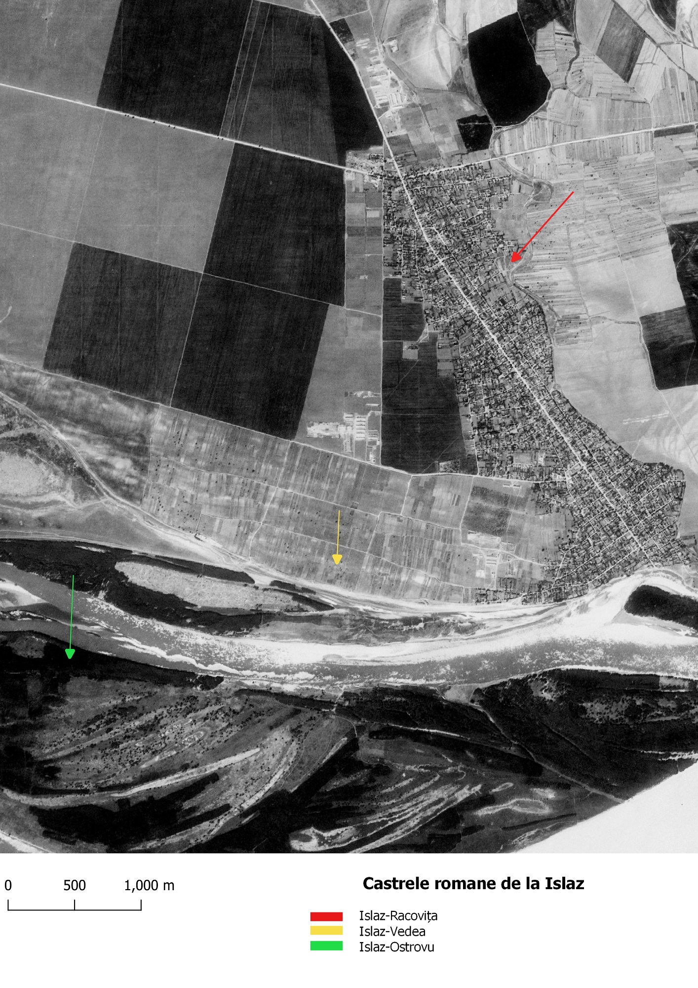
Location of fortifications, declassified 1968 Corona satellite photo (1103-1058 Fore; May 05, 1968_Center for Advanced Spatial Technologies, University of Arkansas/U.S. Geological Survey)
Three forts were reported in the vicinity of Islaz village, two located near the Danube and one on the bank of the Olt river. One is completely destroyed by the Danube.
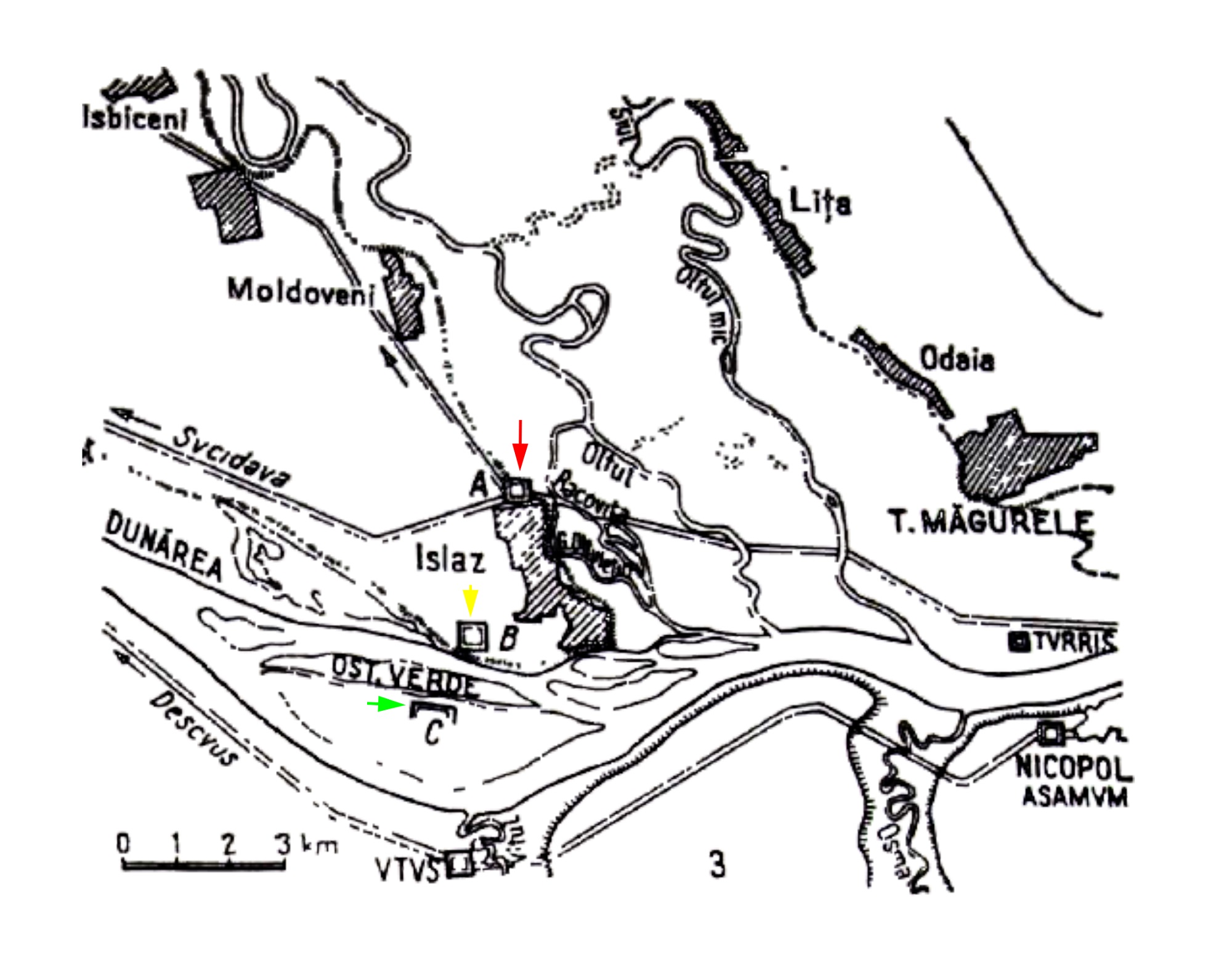
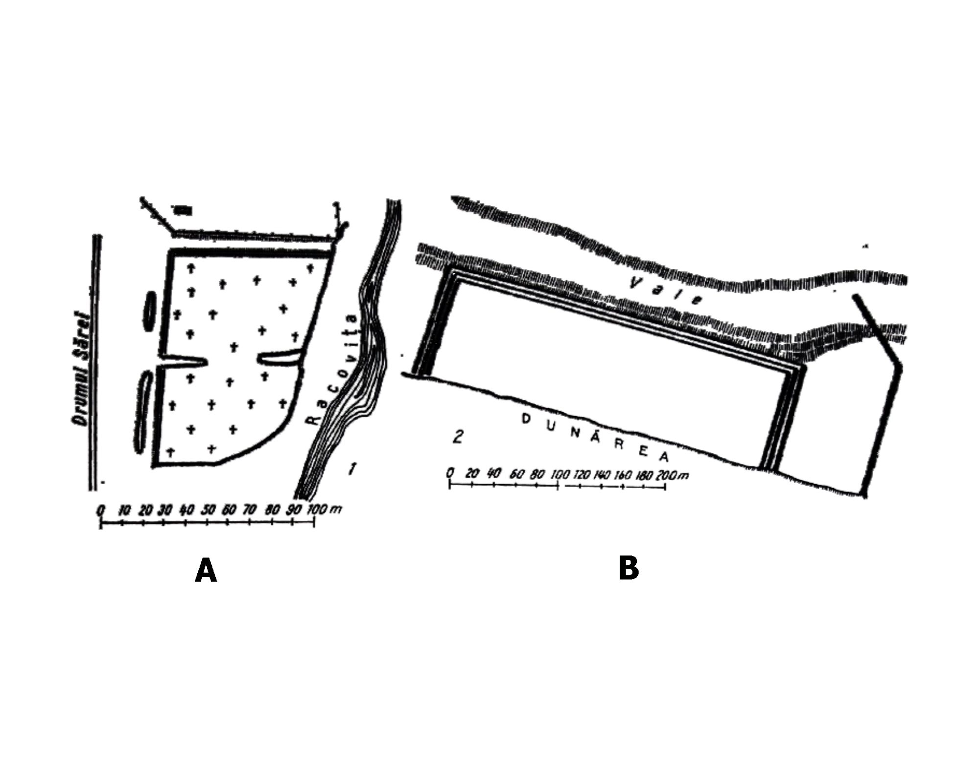
Of these, one with a stone enclosure was mentioned in the point “Cetatea Racovița”, located northeast of the present settlement, in a marshy area of Racovița creek, which flows into the Olt. The name Islaz-Racovița comes from the nearby stream.
Only the north-west corner (75×105 m) was preserved, with a rampart and a defensive ditch. Roman bricks and ceramic fragments have been identified. They could date from Trajan’s era, but definite elements are missing. There are no visible traces on the surface, the fortification being almost entirely destroyed by erosion and the village cemetery.
Castrele de la Islaz (Tudor 1978, 266, fig. 68/3)
The castles of Islaz Racovița (A) and Islaz Vedea (B) (Tudor 1978, 278, fig. 75/1-2)
Islaz-Racovita, site location (A).
A fortification was reported at the point “Cetatea Verdea”, located southwest of Islaz, on an island of the Danube, near where the Olt flows into the Danube. The name Vedea (or Verdea) comes from the former Verdea island, formed by the course of the Danube (preserved on the military maps). The fortification was located about one km north of this island (fig. 24.2.B. – yellow; fig. 24.5). It was heavily damaged by the course of the river, being largely destroyed. Certain observations were made in 1876 by A. T. Laurian, when three ditches and three ramparts were visible, which outlined a fort measuring 120×340 m. Finds of stone sarcophagi and coins dated to the time of Septimius Severus, as well as a sestertius dated to the period of Trajan, were mentioned at the time.
In 1977, several surveys were carried out in which structures were discovered that can be attributed to the Roman civil settlement. Ioana Bogdan-Cătăniciu assumed that this fort was built in Hadrian’s time.
The third fortification reported by Laurian and Bolliac (95×122 m), a location from which much Roman brick was extracted, was completely destroyed. It may be the Islaz-Ostrovu point (fig. 24.2.c. – green). It is listed under the name Ostrovul Verde /Ostrovul Calnovăț on the military maps.
Islaz-Vedea, site location (B)
Islaz-Ostrovu, site location (C)
Part of the study:
Ovidiu Țentea, Florian Matei-Popescu, Vlad Călina, Frontiera romană din Dacia Inferior. O trecere în revistă și o actualizare. 1., Cercetări Arheologice, Vol. 28.1, pag. 9-90, 2021, doi: https://doi.org/10.46535/ca.28.1.01
Tudor 1978, 279; Cătăniciu 1981, 30; Vlădescu 1983, 81, nr. 6; Vlădescu 1986, 29-30; Gudea 1997, 82, nr. 67; Gudea 2005, 492, nr. VII. B. 1; Dudău 2006, 116; Marcu 2009, 212, nr. 56.