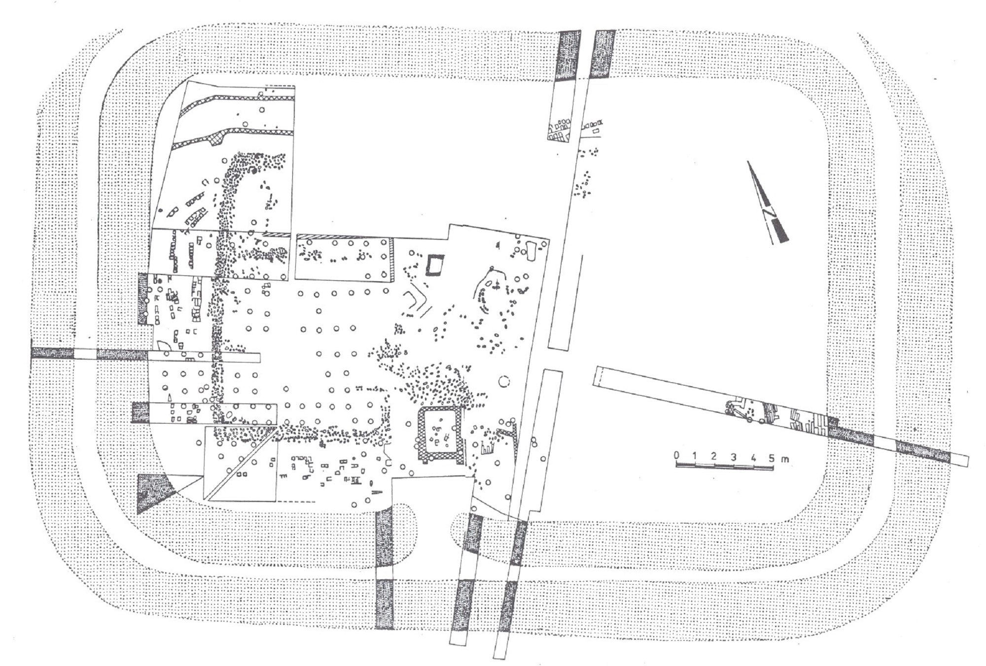
Castellum built in a strategic position S of Bran Pass; located N from the present village, on a low terrace in the area where the rivers Roghina and Cernea flow in Dâmboviţa, at the point “Scărișoara” or “Câmpul Rucărului”; Research: D. Bajan 1904; I. Bogdan-Cătăniciu 1971-1975 and 1979-1985, about 40% of the fortification area (SW corner) was researched; a single phase was observed: 1. wood and earth castellum, rectangular plan, having dimensions of 40×60 m; on the S side: rampart 5.10 m wide and 0.80 m high, surrounded by two ditches, of approx. 5.10 m wide and 1.20 m in depth; at the SE corner the traces of a wooden tower were identified; via sagularis with a width of 1 m; inside were discovered traces of the buildings in the centre of the fortification and the presence of two barracks was assumed, each having 4 contubernia; dating: Trajan epoch – tegular material from cohort II Flavia Bessorum (IDR II 607), monetary discoveries ending at 114/117, terra sigillata from the beginning of the century. II; 150 m from the fort the thermae were identified; the thermal edifice was only probed by Ioana Bogdan Cătăniciu; dimensions:21×16 m.
D. Tudor, SCIV 6, 1-2, 1955, 90-93 și fig. 3 (planul termelor); TIR L 35, 62; I. Bogdan-Cătăniciu, SCIV 25, 1974, 277-288; Tudor 1978, 297-298, 323; Beneš 1978, 18; Bogdan-Cătăniciu 1997, 45-47; Gudea 1997, 81, nr. 65; Gudea 2005, 500, nr. VII. C. 1b; Marcu 2009, 230, nr. 68; RepArgeș, 155-156, nr. 444.