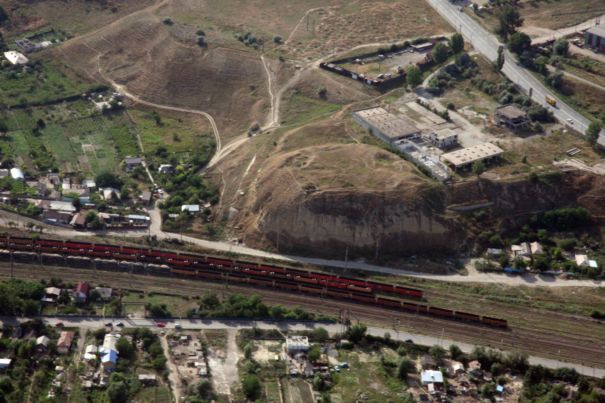
Oblique aerial photograph. Ioana Oltean, W.S. Hanson – iulie 2008, arhivă STRATEG. Strategii defensive şi politici transfrontaliere. Integrarea spaţiului Dunării de Jos în civilizaţia romană. CNMP 91-010, 2007-2010. www.strateg.org.ro)
The auxiliary fort was mentioned at the point “Tirighina”, a high plateau located on the left bank of Siret, 2.5 km from the current confluence with the Danube.
The Barboși settlement had a special importance in the area of the Lower Danube due to its special geographical location, near the confluence of the Danube with Siret. The ruins entered the scientific debate more than 170 years ago, through the work of Gh. Săulescu. The settlement located on the Tirighina promontory is known in the medieval period as Ghertina (Gherghina). The headland has been affected by sporadic habitation dating back to the 17th – 18th centuries, by military installations during WW I or by modern destruction due to the large-scale extraction of stone.
The entry of this space under Roman control occurs most likely at the beginning of the 2nd century, the fort being almost certainly built during the time of Trajan. Two honorary inscriptions attest to works carried out in the fort during the reign of emperors Trajan and Hadrian. From the period of the V Macedonica legion’s stationing at Troesmis date the stamps of this unit that were discovered at Barboși (ISM V 305). Stamps with the name of the legion I Italica were also attested here (ISM V 307; also a centurio, ISM V 297, probably leading the detachment stationed at Barboși and a medicus legionis, ISM V 299), cohors II Mattiacorum equitata (ISM V 306), respectively classis Flavia Moesica (ISM V 308).
Plan of the Roman castrum
Interpretation of the distribution of archaeological remains inside the Traian-Tulucești valley, according to aerial photographs taken in 1944 (Țentea, Oltean 2009, 1521 fig. 4)
The location of the Barboși camp during the Principate was rather uncertain. The place where the Roman garrison consisting of vexillations of various military units was stationed was suggested to be around the Tirighina promontory.
The idea of the existence of a fort larger than the Tirighina promontory, to enclose a castellum, was formulated by S. Sanie and taken up by several authors. The inaccuracies refer to both the chronology of the two alleged fortifications, fort, respectively castellum, and how the fortifications, the civil settlement, and the necropolis were located and functioned. A Roman fortification with a large garrison could not function on the small Tirighina promontory. This place could have served at most as an observation and/or signaling point.
The only possibility for the existence of a Roman fortification (with dimensions not yet specified) was indicated on the edge of the high plateau in the vicinity of the Tirighina promontory, near the road, where, on the plan made by Vasile Pârvan were marked “ancient ramparts”, corresponding to the system of fortifications on the northern side. During preventive archaeological research conducted in 2017 and 2019, the northern enclosure and a ditch were discovered, which doubles it to the north (kind information from Florin Topoleanu and Gabriel Jugănaru, to whom we also thank on this occasion. The report is under print in Cronica Cercetărilor Arheologice din România, 2019 campaign, Bucharest 2020).
Probably starting with the period of Emperor Hadrian, Barboşi became the centre of the territory (territorium or regio) delimited by the wave from Traian-Tuluceşti, under military administration. This wave (also called Valul Galaţilor) has a length of 23 km, following a route in the form of a circle segment, with the centre at Galaţi. It is over 3m in height in its southern portion in the Traian village area, and due to its flattening by agricultural works, it can reach a width of about 30 m. A wide ditch doubles it to the west and north, respectively.
A small fortification (fortlet) was investigated in Galați, Danube district. Small rectangular structures were also mapped, inside the wave, to the west of Balta Mălina.
Map of burial finds in the area of the confluence of the Siret River with the Danube - administrative areas (after Țentea, Rațiu 2015, pl. VIII)
Roman fortifications inside the Trajan-Tulucești Trench
In order to outline an overview of the distribution of the burial complexes in the Barboşi necropolis, we corroborated the maps of our own archaeological research with those obtained based on aerial photographs taken during WW2[1]. Thus, we intend to extend the research to all the funerary discoveries in the space bounded by Valul Traian–Tulucești and the related area. Cartographic support was provided by the platform http://geo-spatial.org, and data integration was achieved with the use of Open Source. The usefulness of this process was validated when integrating the data recorded on the field.
Ovidiu Țentea, Ioan C. Opriș, Florian Matei-Popescu, Alexandru Rațiu, Constantin Băjenaru, Vlad Călina, Frontiera romană din Dobrogea. O trecere în revistă și o actualizare, Cercetări Arheologice, Vol. 26, pag. 9-82, 2019, doi: https://doi.org/10.46535/ca.26.01
V. Pârvan, Castrul de la Poiana şi drumul roman prin Moldova de Jos, AARMSI II, XXXVL, 1913; 1-38, IX pl.; S. Sanie, Civilizaţia romană la est de Carpaţi şi romanitatea pe teritoriul Moldovei (sec. II î. Hr.-III d. Hr.), Iaşi 1981; L. Petculescu, Despre cronologia fortificaţiilor romane de la Bărboşi, Pontica 15, 1982, 249-253; Ţentea, Oltean 2009, 1515–1524; O. Țentea, Al. Rațiu, Repertoriul peisajului funerar din zona confluenței Siretului cu Dunărea – studiu preliminar, Cercetări Arheologice 22, 2015, 189–270.